![]()
Rivers are highways that move on, and bear us whither we wish to go. Pascal. A history of the river ways of Northeast Missouri would seem a travesty on truth, a parody on existing facts, if the Mississippi and Missouri rivers were not given such mention as their importance to this section of Missouri suggests and merits. Northeast Missouri, unlike any other section of the United States, except southeast Missouri, is bounded on two sides by two of the largest and most important navigable streams in the world, the Mississippi, lapping her eastern shores for approximately two hundred and fifty miles, furnishing water fronts and shipping facilities to seven of her counties, Clark, Lewis, Marion, Ralls, Pike, Lincoln and St. Charles; while the Missouri performs the same service along her southern shores for a like number of counties and equal mileage, touching St. Charles, Warren, Montgomery, Callaway, Boone, Howard and Chariton. The Mississippi River The Mississippi River forms the entire eastern border of Northeast Missouri and is the waterway to the Gulf of Mexico for her various tributaries that have their sources within the confines of the counties embraced in Northeast Missouri, or have their origin far beyond the state boundary line to the northward. The great "Father of Waters" is therefore one of the great natural public utilities of this fortunate section of our great state, which derives most profitable and advantageous facilities and resources from its beneficial privileges and uses. This river should be mentioned here because it is the natural aqueduct or watershed to the sea for many of the smaller rivers to be hereafter mentioned as conducive to the commercial and agricultural benefits and interests of this section. The Indians called it "Missi Sepe," the accredited meaning of which, in their tongue, is "Great River." The distance from its source, Lake Itasca, in northern Minnesota, to the Gulf of Mexico, is about two thousand nine hundred and sixty miles. It is navigable for about one thousand nine hundred and forty-four miles, and consequently entirely across the section of country to be considered in this chapter. As a brief matter of history attaching to it, it should be noted that its mouth was discovered in 1519 by Pineda; it was crossed near its mouth in 1528 by Cabeza de Vaca, but he supposed it was only an arm of the sea, and dismissed its further exploration under that belief. It was not until 1541 that DeSoto discovered its true character as a most wonderful and valuable inland stream; and in 1542 the survivors of his party, lead by Luis de Moscoso, descended the river to its mouth, or entrance into the Gulf of Mexico, In 1673 Pere Marquette and Louis Joliet discovered what is known as the upper Mississippi, which part most concerns this territory. In 1682 La Salle explored it from the Illinois River to the gulf, but the source was not really discovered until 1832, by Schoolcraft. The French called it the River St. Louis. The two principal cities of Northeast Missouri along the west bank of this river are Hannibal in Marion county and Louisiana in Pike county, both prosperous and progressive towns. Like the Missouri river on the south, it is the main sewer, so to speak, for the many drainage laterals and sub-laterals in the way of smaller rivers and creeks flowing through Northeast Missouri and seeking their natural outlets into this great inland stream, thence to the gulf, the great basin receptacle for all our western waters, until, as it bids adieu to the fertile shores of this portion of our state, it receives the waters of its greatest and longest tributary, the Missouri river, which, flowing along the southern border of St. Charles County, empties into it about twenty miles above St. Louis.
The Missouri River The Missouri river, in reality the longer of the two streams, was first seen by white men, early French explorers, about July 1, 1673, when they were descending the Mississippi River, who called it "Pekitanoui," the name which appears on some of the earliest maps. It so impressed everyone with its muddy appearance that it was later called Missouri, from the Indian word for muddy water. The Missouri originates in southwest Montana by the uniting of the Jefferson, Madison and Gallatin rivers, known as the "Three Forks of the Missouri," flowing northeastwardly through Montana into North Dakota, between Nebraska and Iowa, and between Kansas and Missouri until it reaches Kansas City, Missouri; thence eastwardly across the state, constantly bearing to the south, however, forming the southern boundary of Northeast Missouri until it runs athwart the clear, blue current of the Mississippi, emptying its turbulent torrent of muddy waters into that of the other great world-known waterway, rushing on to the gulf. The current of the Missouri is very swift at all times, owing to the fact that the waters have a grade, by actual measurement, of ten inches to the mile, a very unusual fall, especially for so large a stream. Its length above its confluence with the Mississippi, or its mouth as it is commonly called, is about twenty-five hundred and forty-seven miles, but including the Jefferson branch of the three forks, ia given by the Mississippi and Missouri River Commission as twenty-nine hundred and forty-five miles, making its length to the gulf thirty-eight hundred and twenty-three miles, counting the distance by the Mississippi river from the mouth of the Missouri to the gulf. Undoubtedly, had the Missouri river been ascended first it would have been the main stream, from the Rocky Mountains to the Gulf of Mexico, the longest and grandest river in the world.
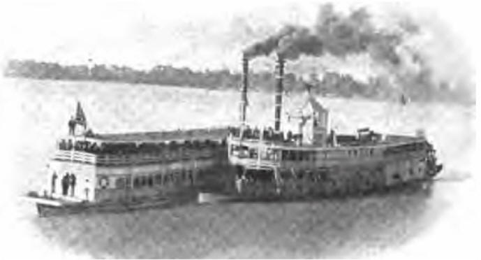
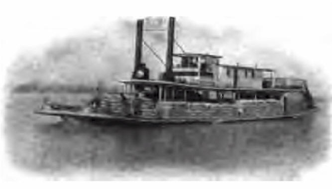
This river was again explored in 1804 and 1805 by Lewis and Clark, and like the Mississippi, had been called by the French explorers, in honor of a ruler of France, the river St. Philip. Owing to the steep grade and resultant swift current, this river was for years considered un-navigable, supposing that no keel boat could ascend so swift a current. However, this question was settled by the enterprising spirit of progress and perseverance of George Sarpy, who sent Captain Labrosse to experiment on the difficult task. He was successful, and on May 15, 1819, Captain Nelson, of Louisville, Kentucky, succeeded in navigating the stream and safely landed the Independence at Old Franklin, Howard county, a town of Northeast Missouri, then the largest and most prosperous commercial and educational center west of St. Louis, opening even at that early day the great advantages of river traffic to Northeast Missouri, extending entirely across its southern, as well as across its eastern border, as the Independence is said to have soon thereafter proceeded as far as the Grand River, the farthest west of the Northeast Missouri rivers to be considered in this chapter. In 1819 the government sent another expedition up this river to ascertain how far it was navigable and to establish a line of military posts. This expedition left St. Louis on June 1, 1819, in the Western Engineer for the mouth of the Yellowstone, with Col. Henry Adkinson's command. Like the Mississippi river on the east, the Missouri River has furnished to the several southern counties of Northeast Missouri along its entire southern boundary line all the great advantages of a river traffic and trade, and has been of untold benefit and advantage in days past, when the palatial river steamboats did the passenger and freight traffic of the entire west, before the days of railroads, trolley lines, aeroplanes and automobiles. Smaller Streams The tributaries to these two great natural waterways all flow either eastwardly or southeastwardly into the Mississippi or into the Missouri river, thus affording this favored portion of Missouri all the natural advantages and in a most marked degree, of river irrigation, sewerage and drainage. While these tributaries, creeks and rivulets are not admissible under the government specifications as navigable streams, except the Grand and Chariton for very small craft, they serve a most valuable and profitable purpose in giving Northeast Missouri the reputation of being as well watered a country as any part of Missouri, which bears the distinction of being at least among the best watered states of this or any other country. These small rivers and creeks, while not navigable, are so distributed over this section of Missouri that they naturally form rich valleys many miles wide, with uniform surfaces carpeted in nature's verdant colors, with the various feed grasses or other graminaceous herbs indigenous to such conditions, making not only a picture pleasing to the eye, but affording forests, foliage and timber that produce prosperity and plenty for man and beast, and render it ideal for homes and domestic purposes, an abiding place for rich or poor alike. This naturally presupposes a resultant fact, that this section is well supplied with babbling brooks and bold and bubbling springs of pure waters; or perhaps, of mineral waters, such as saline, sulphur, chalybeate, for springs are generally the sources of our smaller creeks and branches, seeking their way to nature's great aqueducts, thus, year after year, eroding and corroding the wrinkles and furrows on the face of Mother Earth, until we have our beautiful vales and valleys, dales, dingles and dells, all doing their part in creating and completing nature's beautiful landscape garden such as is found between the inlets, coves and creeks in northeast Missouri, as her smaller streams seek relief by emptying their overflowing freshets into the two great waterways that pass her doors on their ever-moving march to the sea. Of these smaller rivers the most important is Grand River, forming a part of the western boundary of Northeast Missouri and its principal branch or feeder, the Locust River, flowing south through parts of Putnam, Sullivan and Linn counties. Next in importance is the Chariton River, which, rising in Iowa, runs between Putnam and Schuyler and on south through Adair, Macon and Chariton counties, where it empties into the Missouri river, a few miles west of the Howard county line. Of those emptying into the Mississippi river the Salt River and its numerous feeders, the Cuivre and the Fabius and its several branches, are the principal and deserve special mention. However, for the purposes of this chapter it is best to mention the streams by counties as they each serve their allotted end in carrying out nature's purpose. A road is the means of internal communication between points in any country; a place where one may ride or drive; it is an open way appropriated for public passage and travel for wagons or other vehicles, and is necessary to the good of every community. Ravenel's Road Primer. We will begin with the old roads, the roads of the pioneers and their early descendants, with the "trails," "post roads," "state roads," as they were termed in those early days and develop them as well as is possible to the cross-state highways of today. It is self-evident that the government recognized roads of whatever material, as essentials, and that Northeast Missouri was of as national importance as any other part of Missouri in the very earliest periods of the nineteenth century from the recognition given it by the United States post office department, as evidenced by the partial list of post and stage roads enumerated below. The Boon's Lick Road The Boon's Lick road is one of the oldest roads in Missouri and the unquestioned oldest in Northeast Missouri. It runs from St. Charles to the Boon's Lick Springs in Howard county, about nine miles west-wardly beyond the present town of New Franklin and was first used by Nathaniel and Daniel M., the sons of Daniel Boone, the old pioneer hunter and trapper, and Messrs. Goforth, Baldridge and Manly, for the purpose of reaching the Boon's Lick Springs, where they manufactured salt and shipped to St. Louis, in 1806-7. This road was made a post road by the United States government in 1821 and soon after was legalized as a state road by the Missouri legislature, its eastern end being known as the St. Charles road. This road has now become a part of the Ocean- to Ocean Highway, being the connecting link between the "Cumberland Road" or "National Pike" from St. Louis, via St. Charles, te New Franklin, in Howard county, thence by the Missouri avenue to the Missouri River, at the site of the extinct town of Old Franklin, opposite Boonville, thus connecting this old road with the other old trails portion of the Ocean to Ocean Highway, the Santa Fe trail through Missouri. The Boon's Lick road is an important feature of the roadways of Northeast Missouri from the fact that it traverses the following counties, passing through some of its principal commercial and educational centers: St. Charles, Warren, Montgomery, Callaway, Boone and Howard. The Boon's Lick road was regularly surveyed and established by Nathan Boone, as a commissioner, in 1815 and is undoubtedly the most historic and widely known road to be treated in this work. The Salt River Road The Salt River road, however, follows closely in its chronological record, being ordered laid out in 1823, from St. Charles to the mouth of the Des Moines River. It traverses Northeast Missouri in a direction practically at right angles to the Boon's Lick road, which follows the Missouri River, for it seems to have followed the direction of the Mississippi, leaving it at St. Charles and passing through St. Peters, Troy, Eolia, Louisiana, Hannibal and Palmyra and on to the northward, crossing the counties of St. Charles, Lincoln, Pike, Ralls, Marion, Lewis and part of Clark. Among other "old trails" roads in Northeast Missouri is the Hannibal and St. Joseph road, which is said to have been laid out by William Muldrow, the original of Mark Twain's "Col. Mulberry Sellers," and which is now practically the line of the Hannibal and St. Joe railroad. Wetmore's Gazetteer also refers to a road prior to 1837 from Columbia to Liberty, thence to Fort Leavenworth, which passed through the following Northeast Missouri towns: Sexton's, Payette, Glasgow, Chariton, Keytesville and Grand River, making over seventy miles of it within its confines. There was also a road from Marion City to Franklin and Boonville, running by Palmyra, Clinton, on the South river. Main Salt River, Paris, Mulligan's store. Payette, New Franklin, to the Missouri River "and across the Missouri River to Boonville." making a total distance of one hundred and sixteen miles. There were also in 1836 post routes from Hannibal, by Florida, Paris and Huntsville, to Fayette, and from McMurty's in Callaway County, Thomas Harrison's, on the Grand Prairie, to Huntsville; from Bowling Green, by Bondurant's and Cove Springs to Florida; from Monticello, in Lewis County west wardly to Sandy Hill. As in other states, there was a toll-road day in road construction and maintenance in Missouri, and some of these old roads still exist in Lincoln, Boone and Pike, and possibly other counties, but are not of sufficient length and importance to be treated, except as they may affect individual counties. Missouri Avenue Missouri avenue, above referred to, is in a class by itself in Missouri roads, and for that reason will be given especial notice, and also as being a two-mile link in the Ocean to Ocean Highway, connecting the two most famous and oldest "trails" of pioneer days, the Boon's Lick road and the Sante Fe trail. Years ago, about 1787, the state of New York authorized the raising of revenue for road purposes in a general way by lottery, but only once in this state was that done by legislative enactment and that was for the Missouri avenue, one hundred and twenty feet wide, connecting the two Northeast Missouri towns of New and Old Franklin, in Howard county. While this road is only eighty years old, it is one of the most historic roads in the United States, known since 1833, when it was made a legal entity by the legislature as Missouri avenue, but even better known now as the famous "Lottery road." As early as 1833 it was a self-evident fact that Old Franklin was a doomed town, the erosions of the Missouri river, on the north bank of which it was laid out in 1816, having then for years made daily encroachments upon its water front, until in 1828 but few houses remained. On January 16, 1833, an act of the legislature was approved incorporating the town of the present New Franklin, now practically the west terminus of the Boon's Lick road. Among the powers conferred upon the board of trustees was authority "to raise by lottery a sum of money not exceeding fifteen thousand dollars, for the construction of a railroad from the bank of the Missouri River to the town of New Franklin aforesaid; to provide for the construction and completion of said road, and the application of said fund to that specific object; to fix by ordinance the tolls that shall be paid for the use of said road, after the same shall have been constructed and finished, or for the transportation of goods, wares and merchandise upon said road, and collect the same; to procure by contract the land upon which such road is to be constructed, and to keep the said road in repair." On February 8, 1839, an act of the legislature was approved annulling the act of 1833, changing the railroad to a macadamized road and taking from the trustees the power to raise the money by lottery, and conferring the power on the governor in these words: "The governor may by proclamation authorize the board of trustees to raise by lottery such amount as may be necessary to complete the road." On February 24, 1853 another act was approved repealing the authority to construct a macadam road and conferring the power to build a plank road. On December 5, 1855, still another act was approved conferring authority on the trustees to construct a plank road, instead of a railroad or a macadam road, as originally provided in the acts of 1833 and 1839. Missouri avenue is still, however, a wide and straight earth road and this record of the acts of the legislature only shows that it was established by law as a connecting link between a point on the Boon's Lick road and Old Franklin, the acknowledged beginning of the Santa Fe trail, and is now a part gf the Ocean to Ocean Highway running through Northeast Missouri. Other State Roads Besides post roads or military roads, as they were sometimes called, surveyed by the war department of the national government, there was a period when state roads were surveyed, whether built in fact or in the engineer's note book. Among this class of roads, in 1840 a state road was surveyed under the direction of three commissioners, from St. Charles to Mexico, the actual survey being made by F. W. Rowland, passing through Truxton and Middletown to Mexico, in Audrain County. Another state road ran from Old Franklin, north to Fayette, thence northwardly through Chariton County. Between 1848 and 1856 there were plank roads built in Boone, Pike, Ralls, Howard and Marion counties, but they were soon worn out and abandoned, or were turned into gravel or toll roads. In about the same period, "corduroy" roads were tried, but naturally proved a "make shift" for a road and were only less of a permanent road than the plank road. The principal post and stage roads in Northeast Missouri with any claims to antiquity, may be enumerated, with approximate dates, as follows:
In 1819, St. Louis to St. Charles
In 1833, St. Charles via Naylor's store. Hickory Grove, Lewiston
and Jones' Tanyard to Fulton, ninety-five miles These were all mail routes both ways, the mail being contracted to be delivered from one to three times a week. In time they all became well-traveled roads and are largely the lines of roadways sought to be improved through the state at this time. Their width was from forty to sixty feet, usually the former. This agitation of the road question took up much of the time of our legislature and continued until the advent of the railroads in the thirties, when it ceased and was largely turned over to the county courts, there to slumber, with little practical or scientific progress until the revived agitation of the last few years, which has attracted nation-wide attention. State Roads by County Special Road Districts As an evidence of the spirit of progress in road interests in northeast Missouri, in many of these counties special eight-mile-square road districts or special benefit assessment road districts have been formed and are still being organized along these "Old Trails," and cross-state highways, with a view to finally bonding them for permanent and uniform grading and rocking. It is not too much to say that this increased and beneficial road agitation is largely due to the endeavors of our State Board of Agriculture, under which the State Highway Department operates, and in particular to our State Highway Engineer, Curtis Hill, whose position is never so important, nor business so pressing, but that he has the time, prompted by the disposition, to courteously answer inquiries and render assistance to the most humble citizen or go miles out of his way to help and encourage them in forming road districts, and in passing professional judgment on highway and engineering problems, always arising to puzzle the layman or inexperienced road builder. Mr. Hill is most generously possessed of the three-fold power, of professional ability, indomitable energy and genuine courtesy, which he dispenses freely and liberally in the belief that a public office is a public trust and that the public official is the servant of the people and should serve all alike. Northeast Missouri| AHGP Missouri | Books on AHGP
Source: History of Northeast Missouri, edited by Walter Williams, Volume I, Lewis Publishing Company, 1913 |
Please stop in again!! |
 |
 |
Copyright August © 2011 - 2025
AHGP -
Judy White
Enjoy the work of our Webmasters, provide a link, don't copy their work.